Rumble Alberta Road Trips
  • Home
    • About Us
    • Contact Us
    • FAQ's
    • Blog
    • Canadian Motorcycle Tourism Association
    • Rider Friendly
    • Animals of Rumble Alberta
    • Member Zone
  • Maps & Tours
  • Plan Trip
  • Members
  • Business
  • Shop
Log in

Register
Register
  • Circle Tours
  • NE AB Route Maps
  • Best of Alberta
  • NW AB Route Maps
  • NC AB Route Map
  • SO AB Route Map
  • SC AB Route Map
  • Other Themed Maps
  • Hidden Gems
  • Métis Culture
  • Indigenous Tourism
  • Rumble Alberta Businesses

Circle Tour: Wetaskiwin to Lloydminster – Prairie Roads, Rail History & Cross-Border Charm

Renee Charbonneau Rumble Alberta Stories | Travel, Road Trips & Hidden Gems 19 September 2025
  • Circle Tours
  • Lloydminster
  • Wetaskiwin
  • NC Alberta
  • NC AB Route Map

Discover Alberta’s Prairie Past & Cross-Border Charm

Wetaskiwin to Lloydminster Circle Tour | Central Alberta Road Trip

This circle tour runs between Wetaskiwin and Lloydminster, carrying you through rolling farmland, historic prairie towns, and communities that hold tight to their cultural roots. It’s a route where you’ll find grain elevators, homestead museums, local cafés, and a sense of prairie pride that stretches from one horizon to the next.


🌾 From Wetaskiwin to Lloydminster: Prairie Highways & Small-Town Stops


Start your journey in Wetaskiwin, a community known for its aviation and automotive heritage courtesey the Reynolds-Alberta Museum. Head east toward Nisku and through Tofield and Ryley, where small cafés and historic main streets invite you to pause.

Continue through Holden and Bruce, both boasting prairie character and community pride. Swing southeast to Viking, hometown of NHL legends, and onward through Irma and Fabyan, where history and quiet prairie beauty mix.

Stop in Wainwright — a major prairie hub — before rolling into Paradise Valley and Blackfoot, gateways to Lloydminster, Alberta’s only border city straddling two provinces.


🏛️ Lloydminster: A Border Story


Half in Alberta, half in Saskatchewan, Lloydminster is a true prairie crossroads. Explore the cultural centres, murals, and the iconic border markers that highlight its unique history. It’s the perfect midpoint of your journey — refuel, recharge, and enjoy the prairie hospitality.


🛣️ From Lloydminster to Wetaskiwin: Return Through the Heartland


Heading back west, follow Highway 13 through Provost and Czar, then weave through Neutral Hills, Veteran, and Coronation — towns rich with pioneer history and prairie grit.

Stop in Halkirk and Castor, both with small-town museums and heritage stops worth your time. Keep rolling into Stettler, a hub for central Alberta’s rail and farming heritage. From there, pass through Botha, Gadsby, Federal, Erskine, Nevis, and Tees — each a snapshot of prairie resilience.

Continue west through Ponoka and Maskwacis, where Indigenous culture and history run deep, before finishing your loop back in Wetaskiwin.


☕ Hidden Gems Along the Way

  • Wainwright Clock Tower & Historic Downtown – A proud prairie landmark

  • Paradise Valley Grain Elevator – Classic Alberta photo stop

  • Stettler Town & Country Museum – Living history of pioneer life

  • Maskwacis Cultural Centre – Learn about the rich history of the Plains Cree

  • Wetaskiwin’s Reynolds-Alberta Museum – Planes, cars, tractors, and more


📸 Pro Tip:
Catch sunset near Wainwright for endless prairie skies, or sunrise outside Coronation, where the flat horizon glows gold.


Maps: NC Map 1  NC Map 2


🏘️ Towns & Communities

Wetaskiwin, Nisku, Tofield, Ryley, Holden, Bruce, Viking, Irma, Fabyan, Wainwright, Paradise Valley, Blackfoot, Lloydminster, Provost, Czar, Neutral Hills, Veteran, Coronation, Halkirk, Castor, Botha, Gadsby, Federal, Erskine, Nevis, Tees, Ponoka, Maskwacis

Bright red Adirondack chairs outside the Mackenzie Crossroads Museum in High Level, Alberta
High Level Mackenzie Crossroads Museum with red chairs for visitors

Circle Tour: High Level to Slave Lake – Remote Roads, Big Lakes & Indigenous Heartlands

Renee Charbonneau Rumble Alberta Stories | Travel, Road Trips & Hidden Gems 19 September 2025
  • Circle Tours
  • Slave Lake
  • NW AB Route Maps
  • NW AB
  • High Level

Discover Northern Alberta’s Remote Roads & Cultural Heartlands

High Level to Slave Lake Circle Tour | NW Alberta Road Trip

This loop between High Level and Slave Lake is Northern Alberta at its best — big skies, quiet towns, and cultural landscapes shaped by the First Peoples who have called this region home for thousands of years.

From boreal forests to wide-open river valleys, this route takes you on a journey where every stop feels like a hidden gem — and every community has a story.


High Level Red Chairs🌲 High Level to Slave Lake: Where the Wild Begins
Start in High Level, a vital hub on the Mackenzie Highway. From here, the road leads you through Paddle Prairie and south to Manning, through forest-lined stretches and peaceful rural towns.

Pause in Marie Reine or take in the dramatic valley views around Peace River — a local favourite for road trippers. From there, you’ll roll through small but vibrant communities like Dixonville, Donnelly, Falher, and Girouxville, before winding into McLennan, Enilda, and High Prairie.

Continue toward Joussard, Grouard, and Kapawe’no First Nation, where lakeside quiet and cultural heritage meet. Then cruise past Kinuso, Canyon Creek, and Driftpile First Nation, finally arriving at Slave Lake, where Lesser Slave Lake stretches to the horizon. 

To see more photos of High Level , visit the High Level album on our Flickr account.


🪶 Stories in the Land: First Nations & Cultural Roots
This region is rich in Indigenous heritage, with communities like Driftpile First Nation, Sucker Creek, Kapawe’no, and Atikameg welcoming respectful travellers.

Slow down. Read the signs. Visit cultural centres when possible. These lands are layered with stories that make the journey deeper.


Lesser Slave🛣️ Return to the North: Slave Lake to High Level
Heading back from Slave Lake, trace the lake’s edge through Canyon Creek, Kinuso, Faust, and Driftpile again.

Stop for a picnic in Joussard or explore the history of Grouard.

From there, head northwest through Atikameg and Red Earth Creek, then make your way to La Crete, known for its Mennonite heritage and famous bakery.

We have some fabulous photos from Le Crete in an album  in our Flickr account.

Swing north into Fort Vermilion — one of Alberta’s oldest settlements — before returning to High Level, full circle.


☕ Hidden Gems Along the Way

  • La Crete Bakery – Known across the north for fresh bread and baked goods

  • Peace River Valley Lookouts – Especially near Marie Reine

  • Fort Vermilion Museum – Preserving fur trade history

  • Kapawe’no Cultural Markers – Stories of resilience and connection

  • Joussard Dock – Great for sunrise and fishing photos


📸 Pro Tip:
Plan your drive for golden hour. The Peace River valley glows near sunset, and Joussard mornings are perfect for lakeside reflection shots.


Maps: NW 9 & NW 10


Towns & Communities:

High Level, Paddle Prairie, Manning, Marie Reine, Peace River, Dixonville, Donnelly, Falher, Girouxville, McLennan, Enilda, High Prairie, Joussard, Grouard, Kapawe’no First Nation, Kinuso, Canyon Creek, Driftpile First Nation, Slave Lake, Sucker Creek First Nation, Atikameg, Red Earth Creek, La Crete, Fort Vermilion

The giant Beaverlodge Beaver statue standing roadside with blue skies in the background
The Beaverlodge Beaver — Alberta’s quirkiest giant rodent and best roadside selfie stop.

Circle Tour: Slave Lake to Fairview – Small-Town Alberta, Hidden Lakes & Big Sky Vibes

Renee Charbonneau Rumble Alberta Stories | Travel, Road Trips & Hidden Gems 19 September 2025
  • Circle Tours
  • Slave Lake
  • Fairview
  • NW AB Route Maps
  • NW AB

Forests, Rivers & Peace Country Roads

Circle Tour: Slave Lake to Fairview – Small-Town Alberta, Hidden Lakes & Big Sky Vibes

This scenic circle tour connects the forested shores of Slave Lake with the golden farmlands of Fairview, weaving through historic towns, Indigenous lands, and big-sky country that defines Northern Alberta. It's the kind of road trip where you lose the crowds, find real community, and come back with stories.


🌲 Lake Life & Northern Waters

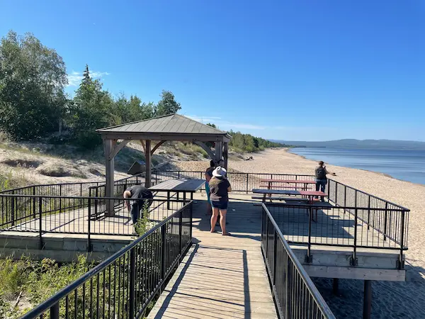
Start your loop in Slave Lake, where the massive blue of Lesser Slave Lake stretches out like an ocean. Think paddleboards, beach walks, and a front-row seat to Alberta’s best northern sunsets.

Not far west, Kinuso, Driftpile First Nation, and Sucker Creek First Nation dot the lakeshore — communities rooted in the land, each with their own stories, fishing spots, and small-town charm.

Keep heading west and you’ll reach Faust and High Prairie — excellent spots to stop, snack, and stretch your legs by the water. Enilda and Brownvale keep things quiet and scenic, while offering unique backroad access to northern trails and rivers.


🪶 Culture, Connection & First Nations Roots

This route brings you through vibrant First Nations and Métis territories. Driftpile First Nation and Sucker Creek First Nation both sit along the lake and are rich in stories, tradition, and hospitality.

Take time to learn and listen — from roadside art to community events and powwows (if your timing’s right), you’ll find this part of the province brimming with spirit and history.

Make a stop in McLennan or Nampa — small but full of character — and head north to Peace River, a riverside hub that mixes arts, history, and amazing valley views.


🏘️ Prairie Towns, Farmland Roads & Hidden Stops

As you roll west into Grimshaw, Bluesky, Berwyn, and Fairview, the trees give way to golden fields. This part of the tour offers classic prairie towns — community murals, quiet coffee shops, and quirky landmarks worth a photo or two.

Fairview itself is full of heart: explore the local museum, stroll through green parks, and visit during summer weekends when farmers’ markets bring the streets to life.


Route 8 Beaverlodge 7013🛣️ The Return Loop: Backroads, Beavers & Big Sky Beauty

On the return leg to Slave Lake, head south on Highway 2 and turn west at Rycroft, taking the scenic back roads through Bay Tree and into Dawson Creek, BC. Swing by Pouce Coupe, then curve east toward Hythe — and if you’re lucky, the Hythe Legion might be open for a visit and a story or two.

Don’t forget to stop for a photo with the iconic Beaverlodge Beaver — a 15-foot roadside legend that’s proudly greeted travellers since 2004.

If you're on schedule, make time for the Philip J. Currie Dinosaur Museum near Wembley — one of the coolest stops on this route. Then cruise into Grande Prairie, up through Clairmont, Sexsmith, and Teepee Creek.

Wind your way through Watino, then swing south to Debolt and Crooked Creek — where the donuts are famous and worth the detour. From there, take Highway 49 back through High Prairie, Sucker Creek, and Driftpile, before rolling back into Slave Lake with a full camera roll and a story-packed heart.


🥧 Small-Town Flavour You Can Taste
And if you're rolling through Sexsmith during harvest, stop for pie.
Local favourites like The Pie Lady, JD’s Pizza & Bakery Outlet, or Crumbs Café & Pizzeria are known for their sweet treats and small-town hospitality. Even if it’s not pie season, you’ll likely find something that hits the spot.


🌟 Did You Know?
Grimshaw is the official Mile Zero of the Mackenzie Highway, a jumping-off point to the true North. And Peace River’s breathtaking valley views are one of the most Instagrammed spots in Northern Alberta.


🚗 Roadside Finds & Trip Tips

Keep your camera handy: moose sightings, vintage signs, and hidden lakes are everywhere up here. Pack a picnic, bring bug spray, and give yourself time to wander — this isn't a rush-through route.

Backroads near Canyon Creek, Rycroft, and Wembley lead to some of Alberta’s most photogenic drives. And if you’re in Grande Prairie, Sexsmith, or Beaverlodge, stop, snack, and soak in that Northern Alberta hospitality.


📸 Pro Tip:


Catch golden hour on the Peace River valley hills or sunrise over Lesser Slave Lake — this loop is made for slow mornings and epic evenings.


Maps: NW 7  NW8


Towns: Slave Lake, Kinuso, Driftpile First Nation, Sucker Creek First Nation, Faust, High Prairie, Enilda, McLennan, Nampa, Grimshaw, Peace River, Berwyn, Bluesky, Brownvale, Fairview, Rycroft, Spirit River, Sexsmith, Beaverlodge, Dawson Creek (BC), Pouce Coupe (BC), Hythe, Wembley, Teepee Creek, Canyon Creek, Wanham, Watino, Bay Tree, Debolt, Crooked Creek

Eddy the Squirrel, Edson’s official town mascot, symbolizing community spirit and local pride.
Meet Eddy the Squirrel — Edson’s beloved mascot and a local favorite for photo ops!

Circle Tour: Edson to Slave Lake | NW Alberta Road Trip

Renee Charbonneau Rumble Alberta Stories | Travel, Road Trips & Hidden Gems 18 September 2025
  • Circle Tours
  • NW Alberta
  • Slave Lake
  • NW AB Route Maps
  • Edson

Mountains, Forests & Northern Lakes

Circle Tour: Edson to Slave Lake | NW Alberta Road Trip


This circle tour connects the foothills town of Edson with the northern waters of Slave Lake, creating a route that blends mountain edges, dense boreal forests, and lake-country beauty. Along the way, you’ll roll through farming communities, timber towns, and First Nations lands — places where Alberta’s landscapes and cultures meet.


🏞️ From Foothills to Forests

Starting in Edson, the western gateway to the Rockies, the landscape shifts quickly from foothills into rolling boreal forest. Peers and Sangudo are classic small Alberta towns, while Whitecourt and Mayerthorpe reflect the province’s forestry and farming heritage.

Near Canyon Creek and Swan Hills, expect big skies, thick forests, and wildlife viewing opportunities. It’s a stretch where moose, deer, and even black bears are often spotted near the roadside.


🌊 Lakeside Highlights

Northern Alberta is lake country, and this tour puts you right in the middle of it.

  • Lesser Slave Lake: Known for Devonshire Beach, one of Alberta’s best sandy beaches.

  • Faust & Canyon Creek: Small lakeside hamlets perfect for fishing and boating.

  • Kinuso & Driftpile First Nation: Communities with deep connections to the water and land.

Make time to stop at the Boreal Centre for Bird Conservation, especially in spring and fall when migrations peak.


🪶 Indigenous & Cultural Connections

This loop includes Driftpile First Nation, Kinuso, Guy, and Falher, each with stories of resilience, culture, and community. Local events, powwows, and cultural sites give travelers a chance to engage with living traditions.

In Fort Assiniboine, history comes alive at the old fort and ferry crossing site, once vital during the fur trade era.


🏘️ Prairie Towns & Local Stops

Towns like Barrhead, Cherhill, Pickardville, and Rochefort Bridge bring prairie hospitality, murals, and classic main streets. Westlock’s Pioneer Museum and High Prairie’s rodeo culture both make for worthy detours.

For a quieter pace, Glenevis, Gunn, and Birch Cove offer roadside cafés, friendly shops, and glimpses of Alberta’s small-town life.


📸 Pro Tip

If you’re traveling in summer, plan an overnight stop at Slave Lake. Catch sunset on Devonshire Beach, then wake up early to hike the Lesser Slave Lake trails for spectacular sunrise views.


Maps: NW R5 & NW R6

Towns: Edson, Slave Lake, Whitecourt, Barrhead, Mayerthorpe, Swan Hills, Canyon Creek, Peers, Sangudo, Cherhill, Birch Cove, Gunn, Glenevis, Pickardville, Rochefort Bridge, Fort Assiniboine, Westlock, Clairmont, Driftpile First Nation, Enilda, Falher, Faust, Grande Cache, Grande Prairie, Guy, High Prairie, Hinton, Kinuso, Rycroft, Sexsmith, Wanham

Main street in Wildwood, Alberta, with small shops and prairie town charm.
Wildwood, Alberta — a gateway town with prairie roots and small-town character.

Circle Tour: Wildwood to Slave Lake | NW Alberta Road Trip

Renee Charbonneau Rumble Alberta Stories | Travel, Road Trips & Hidden Gems 18 September 2025
  • Circle Tours
  • Slave Lake
  • NW AB Route Maps
  • NW AB
  • Wildwood

Forests, Rivers & Prairie Horizons

Circle Tour: Wildwood to Slave Lake | NW Alberta Road Trip


This circle tour links Wildwood, in central Alberta’s parkland, with the northern waters of Slave Lake. It’s a route that carries you through boreal forests, river valleys, prairie towns, and small farming communities — a true sampler of everything Alberta’s heartland has to offer. From lakeside sunsets to roadside diners, this drive is packed with both scenery and stories.


🌲 Forest Trails & River Crossings

Heading north, you’ll pass through Flatbush, Smith, and Wandering River, communities that sit at the edge of Alberta’s boreal. Smith is especially scenic — where the Lesser Slave and Athabasca Rivers meet, once a vital stop for fur traders and river travelers.

Outdoor lovers will find plenty of hiking, birding, and paddling opportunities in this stretch.


🪶 Heritage & Culture Along the Way

This loop connects you to towns with deep cultural roots:

  • Radway & Thorhild — farming settlements with Ukrainian and Eastern European traditions.

  • Egremont & Waskatenau — small communities with heritage churches, cemeteries, and prairie history.

  • Bon Accord — a town known for its starry skies, once designated as a Dark Sky community.

Each community offers a reminder of the resilience and traditions that shaped Alberta.


🏘️ Prairie Towns & Main Street Moments

On your southern leg, Wildwood, Onoway, Calahoo, and Entwistle capture that classic small-town Alberta feel. Stop for coffee, check out local antique shops, or snap photos of old signage and grain elevators.

Don’t miss Wabamun — famous for its lakeside beach, pier, and Canada’s largest painted outdoor mural. Perfect for stretching your legs before continuing the drive.


🚗 Roadside Stops & Local Gems
Rochester & Perryvale: Quiet farming hamlets with postcard-perfect prairie views.

Jarvie & Fawcett: Known for rodeos and rural hospitality.

Gainford: A hidden stop on Highway 16 near Wabamun Lake.

These are the kinds of towns where pulling off the highway rewards you with stories you won’t find in a regular guidebook — but you will in the Road Trips + Tours Spring/Summer 2025 Guidebook.

👉 Download your free copy when you become a member by registering HERE
Membership & the Guidebook are FREE!


📸 Pro Tip

If you’re heading toward Slave Lake, time your arrival for sunset at Devonshire Beach. The golden light and wide-open views make it one of Alberta’s most photogenic spots.


Maps: NW R3 & NW R4

Towns: Wildwood, Slave Lake, Smith, Wandering River, Flatbush, Atmore, Grassland, Boyle, Radway, Rochester, Thorhild, Egremont, Warspite, Waskatenau, Wellington, Bon Accord, Namao, Gibbons, Calahoo, Onoway, Jarvie, Fawcett, Entwistle, Gainford, Wabamun, Andrew, Newbrook

  1. Circle Tour: Nisku to Slave Lake – Heartland Towns & Lakeside Beauty
  2. Circle Tour: Lloydminster to Two Hills – Borderlands, Parks & Prairie Life
  3. Circle Tour: Cold Lake to Two Hills – Lakelands, Heritage & Prairie Charm
  4. Circle Tour: Two Hills to Anzac – Lakes, Culture & Boreal Beauty

Page 8 of 9

  • 1
  • 2
  • 3
  • 4
  • 5
  • 6
  • 7
  • 8
  • 9
  • What is Rumble Alberta?
  • A Walkthrough
  • Contact Us
  • Privacy Policy
  • Pricing Packages
  • Business Directory
  • Rumble Alberta Stories
  • Animals of Rumble Alberta
  • FAQ's
  • Best of Alberta
  • Merch Shop
  • The Rumble Alberta App
© 2025 Canadian Motorcycle Tourism Association. Rumble Alberta is a CMTA initiative.
Rumble Alberta Road Trips
Sign In
  • Home
    • About Us
    • Contact Us
    • FAQ's
    • Blog
    • Canadian Motorcycle Tourism Association
    • Rider Friendly
    • Animals of Rumble Alberta
    • Member Zone
  • Maps & Tours
  • Plan Trip
  • Members
  • Business
  • Shop